 |
Zoning Overview | Zoning Verification Letter | Code Updates | The Code |BZA | Zoning Change Public Hearings |
CLEVELAND ZONING CODEWhat is Zoning?Use Districts | Height & Area Districts | Variances | Urban Overlay | Townhouse Code | Form Based Code Pilot Project Zoning is a set of laws that restrict and define the type of land uses and development that can occur on each parcel of land in a community. Zoning typically divides a community into districts that group compatible uses together and exclude incompatible uses. Zoning laws typically specify the areas in which residential, industrial, recreational or commercial activities may take place. They also provide regulations that determine building placement (setbacks), height of structures, lot sizes, lot coverage, parking and other requirements. How Does Cleveland's Zoning Code Work?Euclidean Zoning and "Use" DistrictsZones are divided into three basic "use" categories: Residential, Commercial, and Industrial. These categories are then broken into sub-categories. The zones are tiered from most restrictive (residential at the bottom of the pyramid) to least restrictive (industrial at the top). The pyramid works like a nesting doll, uses in the more restrictive districts are also permitted in the less restrictive districts. For instance, a single family home is permitted in the One Family, Two Family and even the General Retail district. A retail use is permitted in the Local Retail, General Retail, Semi-Industry districts but not in the residential districts. The zoning districts work in tandem with the zoning map, meaning that all zoning categories are mapped. 
Zoning Use TableThe zoning table below (PDF Download ) shows how uses, both residential and non-residential, are permitted within zoning districts set forth in Title VII: Zoning Code of the Codified Ordinance of Cleveland, Ohio. Uses are listed on the column to the left. Zoning districts are listed across the top row. Find the corresponding use to the left. Read along to the right of the uses to find out what zoning district(s) your use is either permitted or not permitted.
**Please note: zoning code compliance is determined by the Department of Building & Housing (B&H Home Page) . Final zoning decisions will be made by that department.
For a complete look at permitted uses please view the actual municipal code.
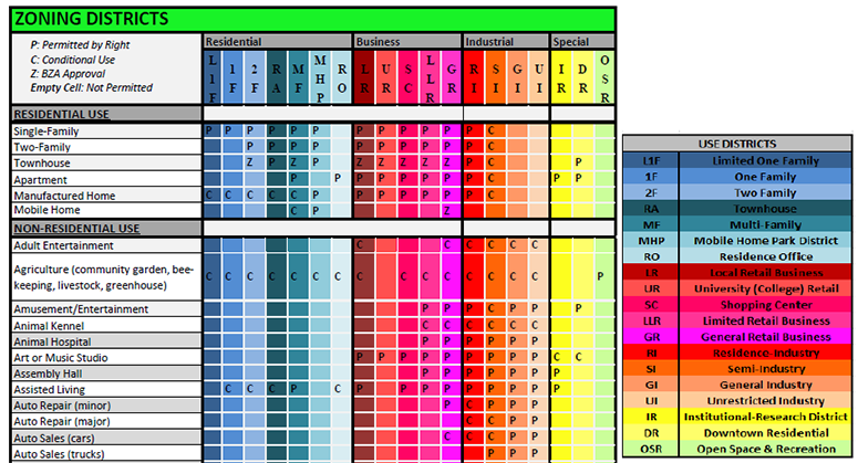
Cleveland Zoning Use Table (Click to download PDF) Height and Area Districts
Use, Area and Height Districts Chart (Click to download (PDF)) Apart from "use" categories, the zoning code also regulates the height of a building and the area a building can occupy on a lot. Area districts only apply to residential structures or in the case of a mixed-use structure, only those floors with residential uses, are taken into consideration in the calculation for an area district. The area districts range from ½ the lot area (indcated as a B district) to 6 times the lot area (indicated as a K district). Height districts range from 1 (35' max. height) to 9 (900' max. height).
Example: 2F-B1:
VariancesIn some instances there may be a need for special consideration of a property or use that is not permitted by the zoning code. This special consideration is called a variance. Property owners can request a variance if they are one zoning sub-category away from what their intended use requires. For example, if a property owner wants to put an apartment building in a Two Family district, the applicant may request a zoning variance. Variances are considered by the Board of Zoning Appeals (BZA) which accepts testimony by both supporters and opposition of a variance. If an intended use is more than one zoning designation away from current zoning designation (e.g. a retail store in a Two-Family zone) the only remedy would be a rezoning. A rezoning is a longer and more scrutinized public process. Similar to a variance, all affected and neighboring property owners are given opportunities to voice their support or opposition. Link: Board of Zoning Appeals Home Page | BZA Fee Schedule
The Urban OverlayCleveland's First Form-Based Zoning DistrictThe Urban Overlay (UO) represents a pivot from segregated-use zoning districts to a form-first philosophy. Modern city dwellers and those who are looking to relocate to cities intuitively understand and are attracted to places built on form-first principles. Ohio City, Gordon Square, Little Italy and downtown Lakewood are examples of this type of development. These dense walkable, mixed-use neighborhoods are an essential element of sustainable 21st living and we will need more of them in order to sustain and grow our City. The Urban Overlay is an essential tool for Cleveland neighborhoods to use in their transition from single-use, auto-centric policies to a healthy, inclusive and sustainable future.
For a full description of the Form Based Zoning Districts you can go to the American Legal Publishing website (Section 348) https://goo.gl/ko7mMX
Urban Form Overlay Evaluation Form We have created a user friendly form that can be used to easily evaluate a project or proposal for compliance with the provisions of the Urban Form Overlay District. Download the form (PDF)
Goals
Use Regulations
Building Setbacks
Building Design
Parking
Common Building Forms without the Urban Overlay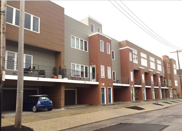
Townhomes
Retail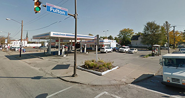
Gas Stations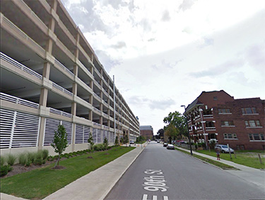
Parking GaragesCommon Building Forms with the Urban Overlay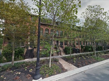
Townhomes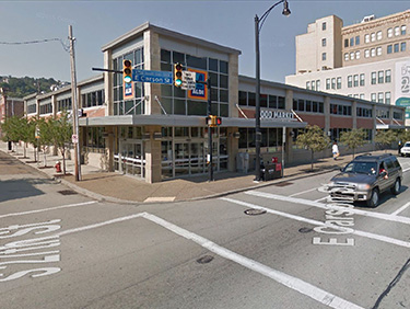
Retail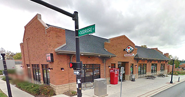
Gas Stations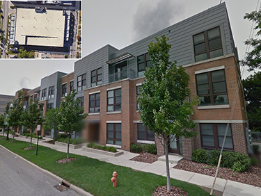
Parking GaragesTownhouse CodeA new Townhouse chapter incorporating the principles of form based codeThe townhouse zoning code was developed to guide the development for townhouse buildings that will support healthy, walkable and safe neighborhoods. The code accomplishes these goals by setting best practices for form, site planning and building features for townhouse developments. Elements like elevated front porches, first floor living areas and rear-loaded garages are regulated design features under the code. By setting high standards for design, the code can better ensure that new townhouses are respectful of their context and add to neighborhood vitality.
Townhouse Code Evaluation Form We have created a user friendly form that can be used to easily evaluate a project or proposal for compliance with the provisions of the townhouse code. Download the form (PDF)
Zoning Verification LettersZoning Letter Request Form (PDF)
For information about Permanent Parcel Numbers (PPN's) you may visit the Cuyahoga County Auditors Website. For permit information contact the Division of Building and Housing at 216.664.2282 or buildingandhousing@city.cleveland.oh.us For existing code violations you can request a "Code Letter" from the Records Administration Section. They can be reached at 216.664.2825, Weekdays 8am-5pm. For Any Special Permits, Conditions or Variances contact the Board of Zoning Appeals – 216.664.2581. |
