 |

|
||||||||||||||||||||||||||||||||||||||||||||||||||||||||||||||||||||
|
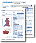
2010 CENSUS DATA 2010 Population - 396,815 2010 Housing Units - 207,536 U.S. Census Bureau website link to Quickfacts for Cleveland 2014 NEIGHBORHOOD FACT SHEETS (SPA's)
CITY OF CLEVELAND TREND DATA 1980 - 2010
2000 CENSUS DATA The City Planning Commission provides Census information for the City of Cleveland. The data is obtained from the U.S. Census Bureau and is then re-organized to meet local needs. The City Planning Commission groups the Cleveland Census Tracts into 36 neighborhood areas (known as Statistical Planning Areas or SPA s ), and then groups those neighborhoods into 6 Planning Districts. Information is also presented for the City's 21 wards.
|